AtoN-Aids to navigation
AtoN, short for “Aids to Navigation,” encompasses specialized structures and technologies like buoys, beacons, marks, and advanced location systems designed to bolster maritime navigation safety. Essential navigation instruments comprise GPS, BEIDOU, GPRS, AIS, Radar, Compass, and traditional paper charts.
Operating without navigation aids or implementing them without standardized guidelines could lead to confusion and potential accidents. Recognizing the critical importance of a uniform buoyage system for global maritime safety, IALA was established.”
Who is IALA?
Established in 1957, the International Association of Marine Aids and Lighthouse Authorities (IALA) is a leading non-profit organization dedicated to maritime safety. With a mission to enhance navigational safety and serve as a protective shield against maritime hazards, IALA offers expert nautical advice and strives to bridge differences in opinions. The organization fosters global collaboration, ensuring vessel movements are not only safe and swift but also cost-effective and environmentally friendly.
One of IALA’s most notable contributions is its buoyage system. Recognizing that over 30 disparate buoyage systems existed worldwide by 1976, IALA introduced a unified, global buoyage system to eliminate confusion and ensure safer navigation for mariners across different regions.
What region am I in?
To ensure a consistent buoyage system worldwide, IALA delineated the globe into two distinct regions: Region A and Region B.
Region A encompasses Europe, Australia, New Zealand, and the majority of other countries. Meanwhile。
Region B includes North, South, and Central America, as well as Japan, Korea, and the Philippines.

IALA introduced a system for the use of lateral marks in both regions. In Region A, red marks the port side of channels, while green indicates the starboard side. Conversely, in Region B, these colors are switched. However, regional differences don’t apply to cardinal, isolated danger, safe water, or special marks.
Light Identification
All navaids within IALA are distinguished by:
Shape
Light
Color
Topmark
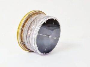
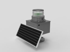
During daytime, the identification of aids to navigation is accomplished by observing buoys’ location, shape, color and marking of names as well as buoy quantities. While at night, we use the features of navigation lanterns to identify it and ascertain its purpose. There are three features to describe the light:
Color– Five colors selected: White, Red, Yellow, Green, and Blue.
Period-the time in seconds needed for one complete cycle of changes

For example the marker indicates the 10 second period of the two flashes including 8 seconds of darkness of a “Fl (2) 10s” light. Except for notably FL (5) 20s , Q (9) 15s and Q (6) + LFL 15s practically all lights have a period of 3 –10 seconds.
Phase characteristic: the particular pattern of changes within one complete cycle (hence, within one period). Intrinsically, the faster the changes, the more important (or greater) the danger that is covered by the light.
| Abbreviation | Class of light | Illustration / description |
| F | Fix |  This light shines with an unblinking and steady intensity and is always on.In this example a yellow fixed light F Y is shown.Often the F is left out, being the default class of light. This light shines with an unblinking and steady intensity and is always on.In this example a yellow fixed light F Y is shown.Often the F is left out, being the default class of light. |
| Occulting: total duration of light longer than total duration of darkness. | ||
| Oc | Single-occulting |  Occulting is the opposite of flashing; the light is more on than off. Occulting is the opposite of flashing; the light is more on than off. |
| Oc (x) | Group-occulting |  This example shows Oc (2). This example shows Oc (2). |
| Oc (x+y) | Composite group-occulting |  This example shows Oc (2+3). This example shows Oc (2+3). |
| Isophase: duration of light and darkness equal. | ||
| Iso | Isophase |  |
| Flashing: less than 50 per minute, and total duration of light shorter than total duration of darkness. | ||
| FI | Single-flashing |  |
| FI (x) | Group-flashing |  This example has three flashes grouped per period: Fl (3) This example has three flashes grouped per period: Fl (3) |
| FI (x+y) | Composite group-flashing |  A combination of two patterns in one period. In this example the first 2 flashes followed by the pattern of 3 flashes result in: Fl (2+1) A combination of two patterns in one period. In this example the first 2 flashes followed by the pattern of 3 flashes result in: Fl (2+1) |
| LFI | Long-flashing |  This light has one long flash (2 seconds or longer) in a period. This light has one long flash (2 seconds or longer) in a period. |
| Quick: repetition rate of 50 to 79 – usually either 50 or 60 – flashes per minute. | ||
| Q | Continuous quick |  |
| Q (x) | Group quick |  This example shows a Q (3) light. This example shows a Q (3) light. |
| IQ | Interrupted quick |  |
| Very quick: repetition rate of 80 to 159 – usually either 100 or 120 – flashes per minute. | ||
| VQ | Continuous Very quick |  |
| VQ(x) | Group very quick |  This example shows a VQ (3) light. This example shows a VQ (3) light. |
| IVQ | Interrupted very quick |  |
| Ultra quick: repetition rate of 160 or more – usually either 240 to 300 – flashes per minute. | ||
| UQ | Continuous Ultra-quick |  |
| IUQ | Interrupted ultra-quick |  |
| Mo(x) | Morse code |  A combination of flashes and long-flashes equivalent to Morse code, in this example the letter “A”: Mo (A), which is often used to indicate safe water. A combination of flashes and long-flashes equivalent to Morse code, in this example the letter “A”: Mo (A), which is often used to indicate safe water. |
| FFI | Fixed and flashing |  |
| AL xy | Alternating |  In this example Al WG is shown, alternating between green and white. This special purpose light is typically used for special applications requiring the exercise of great caution. In this example Al WG is shown, alternating between green and white. This special purpose light is typically used for special applications requiring the exercise of great caution. |
Typical lights with colour, period and phase characteristics:

256IALA Flashing Code (做链接)
Six Types of Navigation Marks
Lateral
Cardinal
Isolated danger
Safe water marks
New wreck
Special Marks
Lateral marks – direction of buoyage
The location of lateral buoys defines the borders of channels, and their characteristics – such as: colour, shape, light, topmark or odd / even number – indicate the direction of channels, traditionally matching the incoming tide, and on a larger scale, clockwise around landmasses.
In Region A, red buoys mark the port side of the channel when returning from sea; “With aching heart (left side) we leave the open waters”.
In Region B, green buoys mark the port side of the channel when returning from sea; “Red Right Returning”.
Numbering
If numbered, they will be numbered from seaward with higher numbers nearer to the coast / port.
The protocol is that green buoys have odd numbers and red ones have even numbers.
Lights
If lit, red buoys have red lights and green buoys have green lights.
Their lights can have any calm phase characteristic except for group flashing FL (2+1), which is specifically reserved for the preferred channel buoys.
Preferred channel markers
Where a channel splits into a major and a minor channel “preferred channel buoys” may be used, indicating whether the preferred channel is to starboard or to port.
These buoys have both red and green coloring, but the main color is that for the major channel, with the coloring for the minor channel being only a stripe.
The light phase characteristic is FL (2+1) with the light color from the major channel.
Shapes
Lateral marks should be of cylindrical and conical shape. However, where they do not rely on a distinctive shape for identification, they should, where practicable, carry the appropriate topmark.


The following non-lateral marks are all identical in both the A and B Regions.
Cardinal marks
The four configurations of cardinal buoys indicate the safe side of a danger with an approximate bearing. For example, the West cardinal buoy has safe water on its West and the danger on its East side.
Body: black and yellow horizontal band(s); pillar or spar.
Topmark: two black cones, with tips pointing towards the black band(s) on the body of the buoy (or beacon), for example for a north cardinal mark, the black band is at the top.
As with the isolated danger mark, the topmark is not optional.
Lights: white quick flashing or very quick flashing.
Notice the clock face resemblance in light phase characteristics:
3 o’clock is East
6 o’clock is South, plus a long flash
9 o’clock is West.

Isolated danger mark
Isolated danger marks are stationed over dangers with navigable water around them.
These buoys are rarely used in sandy regions, such as The Netherlands or Germany.
A typical hazard that justifies an “isolated danger mark” atop of it, is a solitary rock.
Contrastingly, cardinal buoys will indicate a direction away from the danger, and are often used for dangers covering larger objects or areas, such as a wreck, shoal or reef.
Body: black with red horizontal band(s); pillar or spar.
Topmark: 2 black spheres, not optional.

Safe water mark
These marks are used to make landfall and will therefore be to seaward of all other (lateral) buoys, guiding you in.
A second use is to signify the middle or deepest section of a channel.
Body: red and white vertical stripes; pillar, spar, but preferably spherical.
Topmark: single red sphere.
Lights: typically calm and white: Morse A, Iso, Occ or LFl 10s.

New danger mark
After the sinking of the “Tricolor” in the Pas de Calais (Dover Straits) in 2002, several other vessels hit the wreck despite standard radio warnings, three guard ships and a lighted buoy.
This incident spawned a new type of buoy, the emergency wreck marking buoy, which is placed as close as possible to a new dangerous wreck.
The emergency wreck marking buoy will remain in position until:

the wreck is well known and has been promulgated in nautical publications;
the wreck has been fully surveyed and exact details such as position and least depth above the wreck are known; and
a permanent form of marking of the wreck has been carried out.
Body: yellow and blue vertical stripes; pillar or spar, size dependant on location.
Topmark: a standing / upright yellow cross.

Light: Al Oc Bu Y 3s
Blue 1.0s + 0.5s + Yellow 1.0s + 0.5s = 3.0s
If multiple buoys are deployed then the lights will be synchronized.
A racon Morse Code “D” and / or AIS transponder can be used.
Special mark
Marks used to indicate a special area or feature whose nature may be apparent from reference to a chart or other nautical publication. They are not generally intended to mark channels or obstructions where other marks are more suitable.
Body: yellow, any shape not conflicting with lateral marks.

Topmark: single yellow “×” shape
Light: yellow, for instance Fl Y or Fl(4) Y but any rhythm other than those used for white lights on cardinal, isolated danger or safe water marks.
Used for ODAS, cables / pipelines, recreation zones, boundaries (of anchorages), military exercise zones, renewable energy installations and aquaculture.


